
Our system will if you press the address button show you a google map and from there you can get a street view.
However sometimes people looking at this street view, get confused as it does not look right. A typical question, I get is but that place is not there. Well they are not our images even though they appear in our system but google and the most likely reason for what is happening is that it is an old picture. The question still remains if so how can I see that it is an old photo and not an error either in the address we put in or the google system? Well it is easily to do.
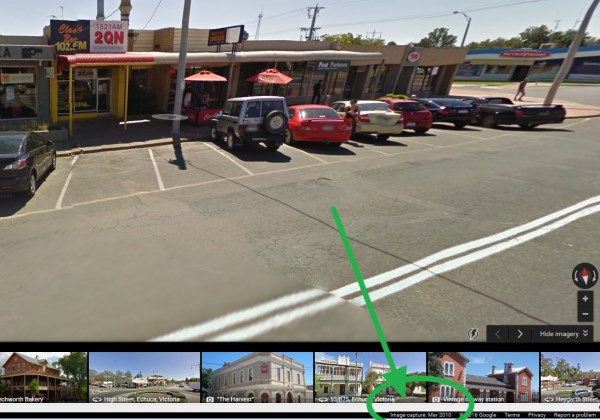
See here a typical street view. Now see where the green arrow is pointing to on the status bar. That is the capture month and year of that image. From that you will be able to tell if it is an old image or there is something else is probabily wrong.